Advanced Electrical Resistivity Tomography for Gold Exploration and Mine Planning
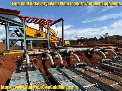
Start Your Own Gold Mine offers advanced Geophysical Surveying using Electrical Resistivity Tomography (ERT) to help clients visualize underground geology before investing in mining operations. By measuring the electrical resistance of subsurface materials, this non-invasive method creates detailed 2D and 3D models that pinpoint high-grade ore zones, groundwater sources, and geological structures, effectively eliminating guesswork and reducing exploration costs. The service follows a systematic four-phase process—from desktop planning and on-site data acquisition with multi-channel meters to advanced modeling and actionable reporting—specifically tailored for both lode and alluvial gold deposits in African regions. Ultimately, this technology enables clients to identify precise drilling targets, assess resource potential, and plan sustainable mining strategies with confidence, serving as a critical first step toward a profitable gold mine.
Service: Advanced Resistivity Imaging & Geophysical Surveys
See Beneath the Surface. Find the Gold. Eliminate the Guesswork.
At Start Your Own Gold Mine, we know that the difference between a profitable mine and a costly failure often comes down to what you can’t see. Before you invest in equipment, labor, and processing plants, you need to know exactly where the gold is hiding.
Our Geophysical Survey Services use advanced Electrical Resistivity Tomography (ERT) and electromagnetic imaging to create a detailed map of your underground geology. We help you pinpoint high-grade ore zones, water sources, and geological structures without digging a single hole.
🔍 What is an Electrical Resistivity Survey?
This is a non-invasive exploration method that measures the electrical resistance of rocks and soils underground. Different materials conduct electricity differently:
- Sulfide-rich ores & mineralized zones often show very low resistivity.
- Solid bedrock (like quartz) typically shows high resistivity.
- Groundwater and clays display unique resistivity signatures.
By sending a small electrical current into the ground and measuring the results, our ADMT series imaging systems generate 2D and 3D models of the subsurface. This allows us to “see” exactly where valuable minerals are concentrated.
✅ Why Choose Our Resistivity Surveys?
Our methodology, which incorporates techniques like Matrix Gold Prospecting, is designed specifically for the Start Your Own Gold Mine client—whether you are exploring for alluvial deposits in a riverbed or tracing a mother lode vein.
| The Challenge | How Our Survey Solves It |
|---|---|
| “Where do I dig?” | We identify high-priority drilling targets, saving you time and money on random trenching. |
| “Is there enough gold?” | We map the potential extent of the ore body to validate resource estimates before you buy equipment. |
| “Is there water for processing?” | We locate groundwater aquifers essential for your processing plant. |
| “What is the rock type?” | We distinguish between overburden, weathered rock (saprolite), and fresh bedrock to plan your mining method. |
🛠️ Our Geophysical Survey Process
We follow a systematic, four-phase approach to ensure you get actionable data, not just raw numbers.
Phase 1: Desktop Study & Planning
- We review existing geological maps, satellite imagery, and historical data for your target region in Africa (Kenya, Uganda, Tanzania, Ghana, etc.).
- We design a survey grid tailored to your specific targets (lode, alluvial, or tailings).
Phase 2: On-Site Data Acquisition
- Our trained geologists deploy multi-channel resistivity meters (e.g., ADMT-300AX-32D) to capture deep subsurface data (down to 300m+).
- We conduct the survey with minimal surface disturbance, respecting the local environment.
Phase 3: 2D/3D Inversion & Modeling
- Raw resistivity data is processed using advanced software to create high-resolution, color-contoured images of the underground.
- We interpret the models to identify anomalies associated with gold-bearing structures (shear zones, quartz veins, paleo-channels).
Phase 4: Targeting & Reporting
- You receive a comprehensive report with:
- Clear maps showing exactly where to dig or drill.
- Recommendations for the next steps (e.g., auger drilling, trenching, or bulk sampling).
- Integration with our Skilled Prospector Course so you understand the data yourself.
- You receive a comprehensive report with:
💡 Applications: What Can We Find?
Our Electrical Resistivity surveys are versatile and effective for the types of deposits we specialize in:
- Lode (Hard Rock) Exploration: Detecting quartz veins, sulfide zones, and structural controls that host gold.
- Alluvial (Placer) Exploration: Mapping the depth of riverbeds, buried channels, and bedrock “false bottoms” where gold settles.
- Tailings Assessment: Evaluating old mine dumps to see if residual gold remains in the material.
- Geotechnical & Water: Locating stable ground for plant construction and finding water for processing.
📊 Ready to See What’s Yours?
Stop investing in luck. Start investing in knowledge. A geophysical survey is the first step toward a profitable, sustainable mining operation.
[Contact Us] to schedule a survey or to discuss how we can integrate resistivity imaging into your Start Your Own Gold Mine package.
Call to Action: Get your free consultation and survey quote today.